SCES
About Engineering Survey Technology (UAV intelligent mapping)
Training objectives:
ForBeijing urban construction and integration of the Beijing-Tianjin-Hebei region, including basic measurement and mapping, aviation construction, territory planning, road and bridge construction, building construction, urban rail transit, training in the mapping of new technologies and UAV technology applications, also management of the high-end technology skilled talents.
Faculty:
There are 19 professional teachers, including 6 professors, 4 associate professors; 5 teachers with doctordegree, 14 teachers have master degree, 11 teachers with UAV pilot license of AOPA (Aircraft Owners and Pilots Association of China). Teachers are well experienced in teaching and social practice. Among all of these teachers, there are 9outstanding ones in Beijing.
Main courses:
Terrain measurement, digital mapping, GNSS satellite positioning measurement, UAV principle and control, UAV digital photogrammetry, engineering survey, precision engineering survey, intelligent urban spatial information technology.
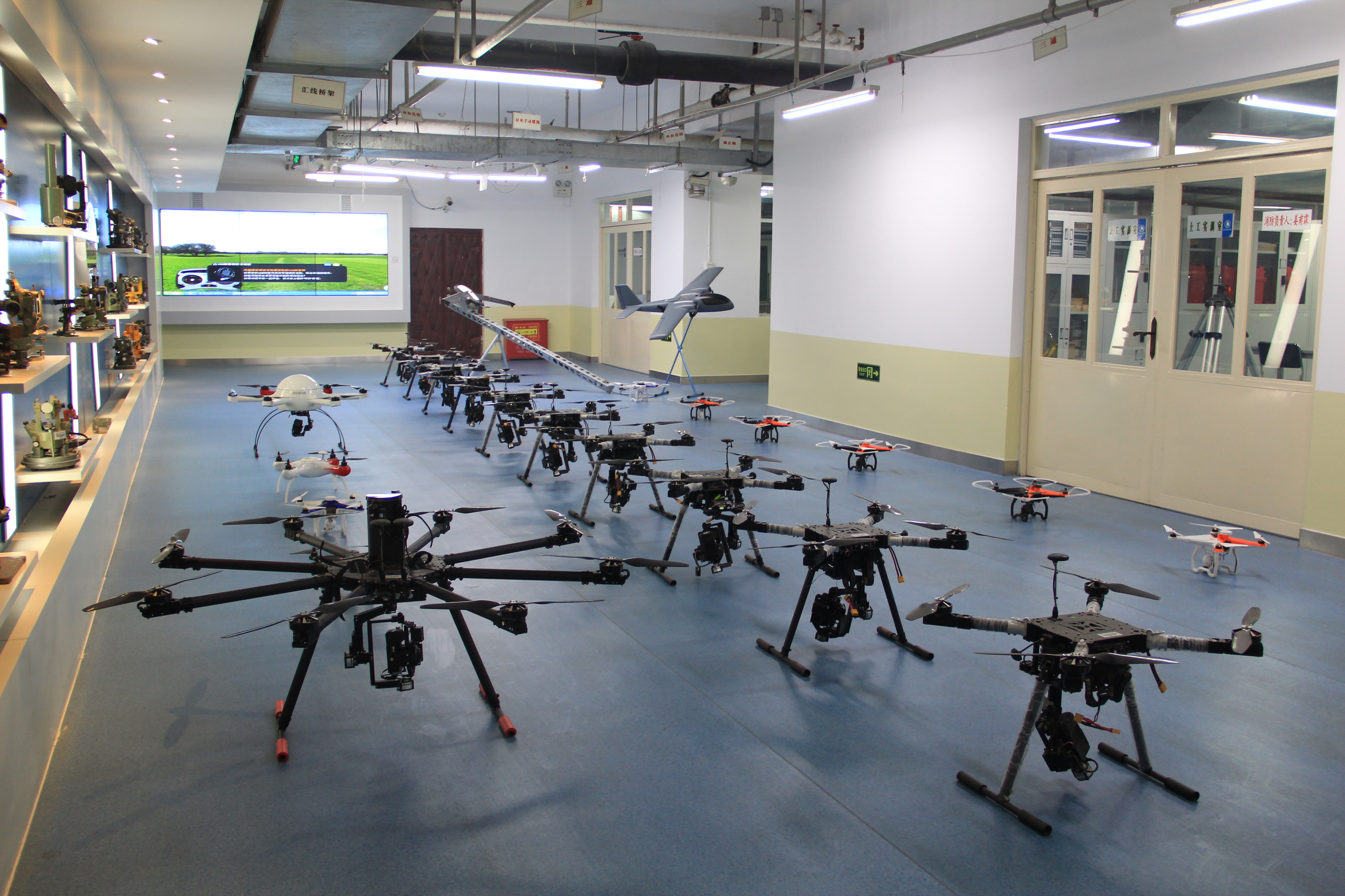
Training conditions:
Program now have unmanned aerial vehicle (UAV) data processing center, digital photogrammetrictraining room, precision engineering measurement training room, topographic measurement training room, digital photogrammetrytraining room, engineering measurement training room, GNSS and control surveytraining room, underground engineering surveytraining room. The training room has advanced training hardware and software equipment, including fixed wing, rotor unmanned aerial vehicle (UAV) more than 50, three-dimensional laser scanning equipment, laser tracker, measuring robot, automatic gyroscope, GNSS receiver, tilt photography measurement system , GNSS ground enhancement system and other hardware. Also it has Smart3D, Pix4D and other data post-processing software, advanced training equipment to fully meet the needs of personnel training.